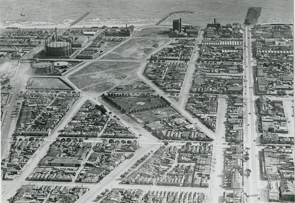
Aerial view of Port Melbourne and Sandridge Lagoon, 1931. You can still see the outline of the former inland body of water in this photo, covered now by housing and parklands in this photo. The former Metropolitan Gas Company Works are at the top left of the image, with Bay Street on the right.
by pastportproject on Aug. 21, 2015Please login to comment on this item