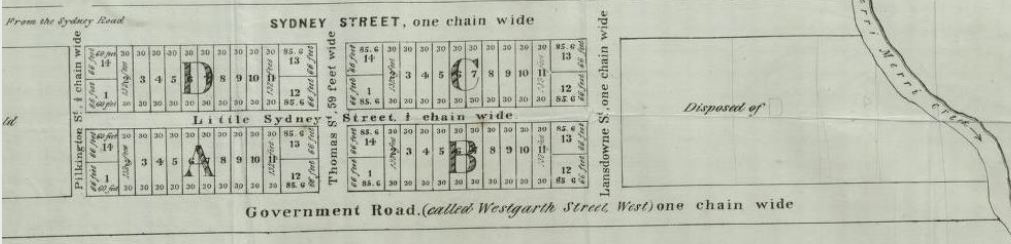
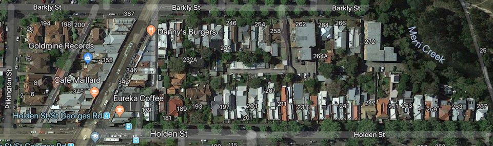
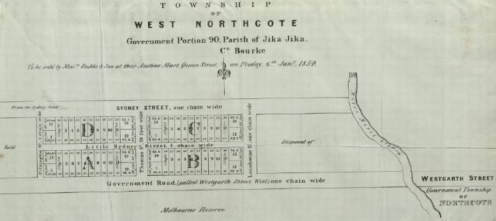
This land had been purchased by William Thomas in 1848, and used as a farm by his son. In 1854 the Government Township of Northcote was established across the Merri Creek and south of Westgarth Street. William Thomas engaged surveyor Robert Russell to prepare this map of his land for its sale in early 1854.The Government Road in Russell's plan of 1854 was also named Westgarth Street West, then later Brunswick Road, and Holden Street since 1881. Sydney Street was later renamed Barkly Street in honour of Sir Henry Barkly, Governor of Victoria from 1856 to 1863. The north-south streets were named after Thomas's children: - Emily Eliza, born c1834, married to Robert Pilkington; - William Jackson Thomas, born c1820, died 1909; - Mary Ann, born c1830, married in October 1849.to William Lansdown, a farmer from Pentridge, Thomas Street and Lansdowne Street were not constructed and were replaced very soon after by the Yan Yean water pipeline and later St Georges Road. Pilkington Street, only 100 metres long, remains today, and dating from 1854, is probably the oldest street name in North Fitzroy.
by MikeMoore on Jan. 16, 2019
Please login to comment on this item