This item is a part of these Themes
Work
Jump To ThemeThere are other records in this place with a similar theme. Explore this theme by jumping to it from here. You can jump back to this piece later.
This item is in these Collections
J Kitchen and Sons Factory site
Jump To CollectionThere are other records in this place that are not on the tour. Explore this place by jumping to it from here. You can jump back to this tour later.
Other content from this author
-
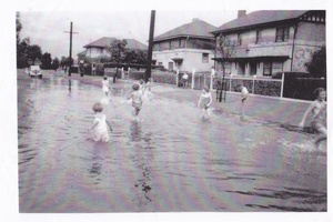
Flood in Crichton Avenue
This photo shows a flood in Crichton Avenue taken in the 1930s. This section of Crichton Avenue is part of the first stage of the Garden City housing development, sponsored by the State Savings Bank of Victoria and constructed in 1927.
pastportproject
-
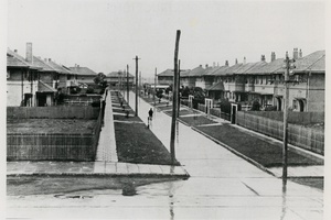
Bank Houses
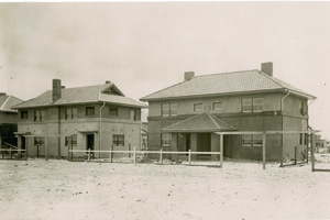
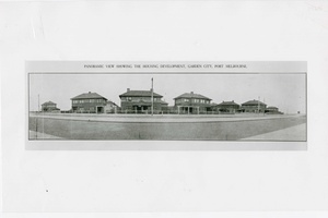
The first houses built at Fishermans Bend were sponsored by State Savings Bank of Victoria, and constructed in 1927 as part of the Garden City housing development. George Emery the bank’s then general manager said in 1925 "In order for buildings to be inexpensive, houses should be two-storey, in pairs, and in large groups. This would provide an overall harmony in the streetscape. This was the popular housing pattern in Britain.” The development followed Emery’s outline, standing in stark contrast to the typical Australian suburban bungalows at the time which were predominantly single storey houses on a large block.
pastportproject
-
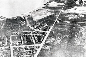
Aerial View
Aerial view of Fishermans Bend, bisected by Williamstown Road, 1927-1940. In this picture you can see the first few stages of the Garden City development, as well as the later Dunstan Estate, completed in 1936.
pastportproject
-
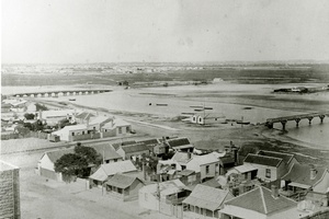
Lagoon
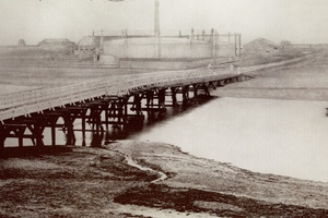
View of the former saltwater Sandridge Lagoon from the Sugar Works, taken in 1873. The Graham Street Bridge is to the left of the image, and Rouse Street to the right. Dow Street is at the bottom of the image. Over time the lagoon gained an unhealthy reputation within the community. For example in 1884, 230 local residents complained to the Harbor Trust about cases of typhoid supposedly emanating from it. The Harbor Trust later responded in 1927 stating “The lagoon has been filled up as far as Bridge Street, and the remainder was like a cesspool, being the receptacle for all the drainage of Emerald Hill and Sandridge.” - The Borough and its People, Margaret and Graham Bride, 2013.
pastportproject
-
Lagoon view
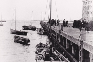
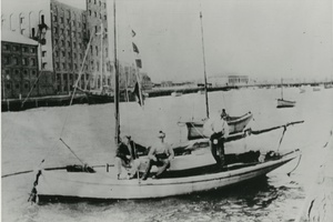
View along the jetty of the Sandridge Lagoon besides Harpers Oatmeal and Starch Factory complex. You can see the remnants of the multi-storey brick Harper’s factory today running along Esplanade West that has been gutted and transformed into apartments.
pastportproject
-
Lagoon 1920
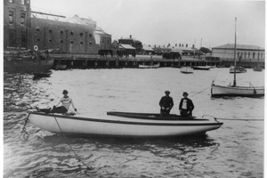
The Sandridge Lagoon looking towards Rouse St in 1920. The Lagoon, which ran all the way up to Ingles Street and was almost 27 acres in size, was slowly filled in by 1929. The Lagoon was popular for boating and fishing as can be seen here in this image.
pastportproject
-
Gas works
In this photograph you can the Metropolitan Gas Company Works, just behind the old Graham Street Bridge. William Westgarth writing in 1888 recalled: "The only other indigenous feature of this somewhat featureless beach which I recall was a little virulently salt lagoon, situated in complete isolation near the bay, and only a hundred yards on the right hand side of the track to Melbourne…without outlet for its briny waters, and in its desolate solitude, it might have aspired to be a sort of tiny dead sea.” - The Borough and its People, Margaret and Graham Bride, 2013.
pastportproject
-
Aerial View
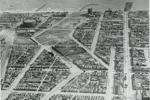
Aerial view of Port Melbourne and Sandridge Lagoon, 1931. You can still see the outline of the former inland body of water in this photo, covered now by housing and parklands in this photo. The former Metropolitan Gas Company Works are at the top left of the image, with Bay Street on the right.
pastportproject
-
Lagoon and the wharf
The Sandridge Lagoon and the wharf outside Harpers Oatmeal and Starch Factory complex, 1900-1929.
pastportproject
-
Factory Hamper
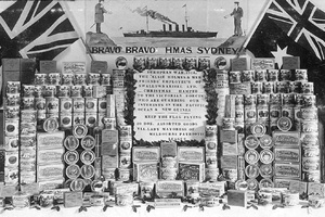
Swallow and Ariell Christmas hampers made for the Victorian Forces on the HMS Sydney serving in the Pacific and New Guinea, 1914.
pastportproject
-
Biscuits
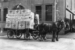
Consignment of biscuits for Prisoners of War in Europe, 1917. Like many large manufacturers of the time, Swallow and Ariell turned much of their efforts to assisting the war effort. Biscuit consignments such as this, as well as plum puddings, were sent overseas to aid the fighting cause.
pastportproject
-
Swallow and Ariell Factory
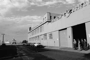
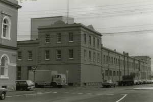
This photo shows the Swallow and Ariell Factory complex, looking down Rose Street, 1979. This factory remains relatively intact externally, and standing here you can see how it has now been turned into apartments. The three storey block on the corner of Rouse and Stokes Streets was built in 1858, with wings stretching along both streets added in the late nineteenth century century. You can see some of the later factory buildings poking out from behind in this image, which have now been removed to create a central courtyard for apartment residents.
pastportproject
-
Factory Drawing
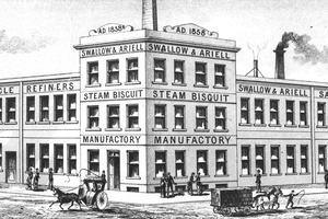
Drawing of the Swallow and Ariell Factory, looking down Princes St, 1885. “By the early 1880s the Port Melbourne factory extended to 3 acres (1.2ha), and the company owned flourmills and sugar plantations in the Goulburn Valley and Northern Queensland. With no equal outside Great Britain, Swallow and Ariell was the fifth largest biscuit company in the world, manufacturing over 100 varieties, including the common ship biscuit (an original product) and meat biscuits (apparently taken by Burke and Wills on their ill-fated expedition)." – Faye Anderson, Encyclopedia of Melbourne online.
pastportproject
-
Bank Housing
The Garden City development was initiated by the State Savings Bank of Victoria in 1926, with 36 houses initially built in the area bound by Williamstown Road, Graham, Poolman and Walter Streets. This photo shows a Garden City Bank House taken in 1935.
pastportproject
-
Poolman Street Houses
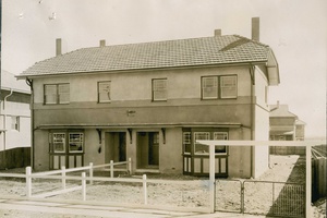
The Garden City development was the first mass provision of housing on a single estate constructed in Victoria, initiated by the State Savings Bank of Victoria . The purchaser was generally required to pay a deposit of 50 pounds upfront, paying the remaining sum off in monthly instalments. This image shows three houses from the first stage of development in 1927.
pastportproject
-
Bank House panorama
Panoramic view showing houses of the Garden City estate in Beacon Road, taken in 1945.
pastportproject
-
Bank House plan
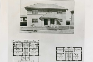
Plans for a Garden City House. As you can see from this plan, the bank houses consisted of double-storey houses grouped together in pairs, giving the appearance of one large house, but containing two separate dwellings. The plans for the houses were mirrored exactly around the dividing wall. The houses were two storey and had a variety of finishes and features, but largely consisting of stuccoed walls with timber framed windows and clay tiled roofs. The houses were designed by G Burridge Leith, the State Savings Bank chief architect.
pastportproject
-
Bank House
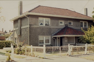
Garden City House, Poolman Street. The Garden City estate contains 161 separate houses, each divided into two dwellings, providing 322 houses overall.
pastportproject
-
Bank House construction
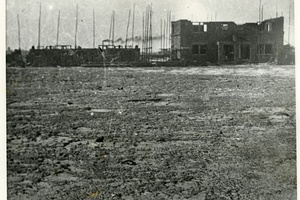
Construction of the first State Savings Bank houses at Garden City, 1927. The Garden City estate was inspired by the English Garden Cities movement of the late 19th and early 20th Centuries, providing large open green spaces, a curving network of roads, spaces allocated for shops and broad, grassed verges.
pastportproject
-
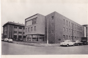
Kitchens amenities block
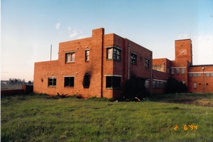
After the sale of the Kitchens site, Symex/Pental (originally J. Kitchens & Sons) donated their large collection of photographs, products, equipment and company documents to the Port Melbourne Historical and Preservation Society. The collection includes these beautiful photographs of the old factory. This image shows the southern aspect of the Amenities Block, 1957, now demolished. The building on the left is the 1925 Kitchen Admin offices. Though neglected and damaged, it remains standing, and is a fine art deco heritage building. It has just been purchased by Channel 9 to be renovated by THE BLOCK contestants.
pastportproject
-
J. Kitchens & Sons Office
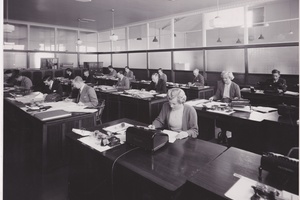
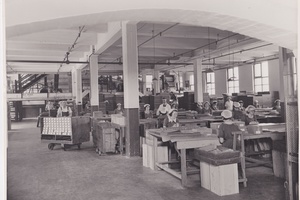
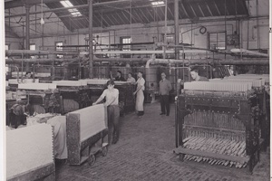
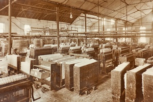
View of the J. Kitchens & Sons office, taken in the late 1950s. J. Kitchens and Sons began making tallow candles in South Melbourne in 1854-5, before moving to Sandridge in 1858 due to the noxious nature of their work. The factory expanded, making candles, soap, glycerine, washing blue and other household chemicals. J. Kitchens & sons are best known for developing Velvet and Solvol soaps. The factory was taken over by Unilever, and eventually Symex/Pental.
pastportproject
-
Staff photo
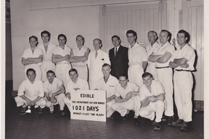
Staff at the J. Kitchens & Sons Factory, 1962. Do you recognise anyone in this photo, or knew someone that worked at the factory?
pastportproject
-
Candle Factory
View of the J. Kitchens & Sons candle factory. Does anybody remember working at the candle factory, or using their candles?
pastportproject
-
Original J. Kitchens & Sons Factory
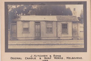
Photo of the original J. Kitchens & Sons candle and soap works, South Melbourne, 1855. “In February 1860 Kitchen’s was the scene of one Port Melbourne’s spectacular fires. John Kitchen, who still lived on the site at the time, gave evidence at the inquest into the fire, that he was awakened by one of his workmen, George Morrell, who slept in the hay loft close to where the fire commenced. George Morrell gave evidence that he saw John Harrison among the spectators who watched the progress of the fire. John Kitchen gave further evidence to say that he had dismissed this Harrison from the factory a few weeks before. Harrison was committed to trial at this inquest but was found not guilty at his subsequent trial” - The Borough and its People, Margaret and Graham Bride, 2013.
pastportproject
-
Railway Pier
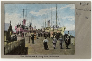
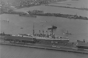
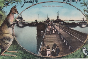
A wonderful hand-tinted postcard showing the Port Melbourne Railway Pier, circa 1914.
pastportproject
-
Station Pier Kiosk
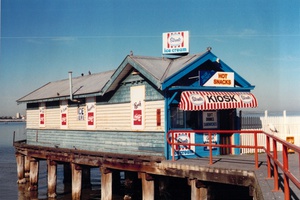
Photo of the eastern Station Pier Kiosk covered in advertising, before it was moved to the shore end of the pier in 1993.
pastportproject
-
Ted Rohan and the Kiosk
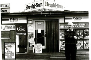
Former owner Ted Rohan, outside the western Station Pier Kiosk in 1993. Ted worked there for 48 years, 7 days a week (25 years without taking a holiday)!
pastportproject
-
Kiosk Watercolour
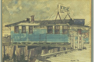
Deni Rohan, daughter of former kiosk owner Ted Rohan, found this watercolour painting of the Station Pier Kiosk, painted in 1993.
pastportproject
-
Nairana
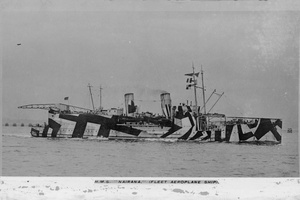
Former local resident David Castles remembers the strange method used to move the Nairana shipwreck. You can see in this image of the Nairana it is decorated with ‘Dazzle’ camouflaging. This image was taken in 1917, when the ship was being used as a Seaplane carrier during the WWI. To read more about the Nairana, follow this link: http://www.pmhps.org.au/2015/02/beached-the-ss-nairana/
pastportproject
-
Coin Pump
Former local resident David Castles recalls the coin operated pump at the petrol station
pastportproject
-
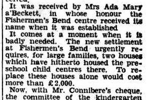
Ada Mary A'Beckett Children's Centre
Former local resident David Castles recounts his time at kinder. Ada Mary A’Beckett was the founder of the Free Kindergarten Union of Victoria, which began in 1908, and helped establish the Kindergarten Training College in Kew. A’Beckett initiated a fundraising appeal to start this Children’s centre, which was initially on Batman road, but moved to Cumberland Road in 1949. The centre was destroyed by fire in 1975, and operated briefly out of the Mission to Seamen building, before being rebuilt.
pastportproject
-
Chocolate Grate
Former local resident David Castles used to think this grate looked like a block of chocolate. What do you think?!
pastportproject
-
Pier Hotel
Former local resident David Castles and his memories of the Old Pier Hotel.
pastportproject
-
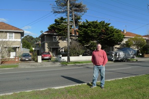
David Castles home
Former local resident David Castles outside his Garden City childhood home
pastportproject
-
Gold Medallion Home
Former local resident David Castles recalls the power at his childhood home
pastportproject
-
Garden City Houses
Former local resident David Castles recalls his pokey childhood home, which was part of the Garden City development.
pastportproject
-
General Motors Holden Factory
Former local resident David Castles recalls walking through the General Motors Holden factory as a child.
pastportproject
-
Old Migrant Hostel
Former local resident David Castles recalls the old Fishermans Bend Migrant Hostel. The Fishermans Bend Migrant Hostel was opened in 1952 and accepted new arrivals until 1975. The hostel was located on the corner of Hall and Turner Streets, and consisted of a series of Nissen Huts and warehouses, leftover from the war. – Biosis, Fishermans Bend Historic Account, 2013.
pastportproject
-
Garden City plans
Conservation architect Fraser Brown discusses the original plans for the Garden City houses, and the surprising variety in them.
pastportproject
-
Garden City colours
Almost all of the original bank houses are now painted grey, but they used to be a riot of colour back when they were first built. Conservation architect Fraser Brown discusses these original colours.
pastportproject
-
New Garden City Houses
Standing here you can see the different variations in the Bank Houses, especially the roof tiles. Local resident, and Conservation architect Fraser Brown explores some of these differences.
pastportproject
-
Garden City house variants
Local Conservation architect Fraser Brown discusses the variants in plan within the original Garden City Houses
pastportproject
-
Ted Rohan at the Kiosk
Deni Rohan talks about her father, Ted Rohan, who worked at the Station Pier western kiosk for 48 years.
pastportproject
-
Migrants arriving at the Pier
Deni Rohan discusses the arrival of migrants at Station Pier.
pastportproject
-
Hobart Star breaks loose
Michael Hill, former local merchant navy sea man, recalls when the Hobart Star broke its mooring at Station Pier
pastportproject
-
Arriving at Station Pier
Local residents Joan and Faris Ahin read a section of their Mother's diary, recalling her arrival into Melbourne. Joan and Faris arrived at Station Pier after travelling from Singapore.
pastportproject
-
Swallow and Ariell Factory Film
A film from 1932 exploring the production at the old Swallow and Ariell biscuit factory. See how Uneeda Biscuits were made, and the elaborate decorating process of their wedding cakes.
pastportproject
-
Mission to Seamen Building
Photo of the former Mission to Seamen building, taken just prior to demolition in 1994. Constructed in 1937 and designed by architect Harry Norris, the Mission to Seaman building was an important part of Port’s maritime history. The video was taken in 1992, and shows the building in a state of decay. Notice the surrounding area, now transformed into the Beacon Cove development. Does anybody remember going through it at this stage? “The new Institute will be a modern two story building in brick, with a high clock-tower, a memorial chapel, a hall for talking pictures, lounges, and billiard-rooms. It will stand in about an acre of ground between the two piers at Port Melbourne. The building of the mission has been made possible by a bequest of about£15,000 by the late Mr. A. M. Nicholas.” – The Argus 19th May, 1937.
pastportproject
-
Port Melbourne Train Station
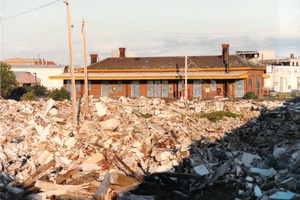
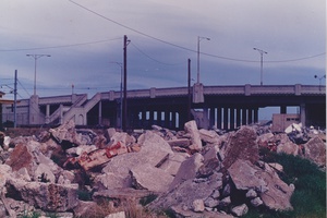
Rubble of the Centenary Bridge in front of the Port Melbourne Train Station, taken in 1991.
pastportproject
-
Milk Bar demolition
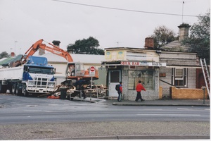
Milk Bar being demolished on Graham Street, does anybody remember this place?
pastportproject
-
Centenary Bridge
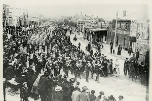
Constructed in 1934, the Art Deco styled Centenary Bridge spanned the railway sidings leading to Station Pier. It was demolished in 1991, and all that remains in a single pylon just east of the pier. The bridge was built to commemorate the first 100 years of European settlement in Victoria. It was apparently built by ‘susso’ labour, people that were on sustenance payments. The Duke of Gloucester, Prince Henry visited Melbourne for the centenary celebrations and his procession was the first to pass over the bridge, officially opening it.
pastportproject
-
J.E Earl Ironmonger and Timber Merchant
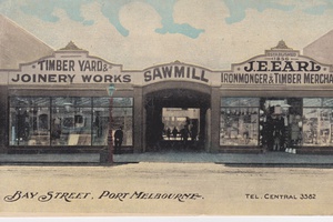
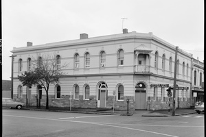
J.E Earl Ironmonger and Timber Merchant was one of two hardware stores on Bay Street, the other being Faram Brothers Hardware. J.E. Earl was established in 1856 originally near the town pier at Beach and Nott Streets, but later moved to this location in the late 19th Century. Only the remnants of the façade remain, but you can see traces of the curved driveway entrance in the entrance to what is now the Bank of Melbourne.
pastportproject
-
Demmler's Boot Shop
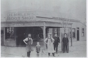
Demmler's Boot Shop, run by Frank Demmler taken in 1910. At the time of the photo Frank and his Wife Sarah lived in the small shop/house with five children.
pastportproject
-
Intro
When we look down Port Melbourne’s Bay Street today we see it lined with upmarket boutiques, restaurants, cafés and shops. Dotted along either side are also several pubs and hotels from the ‘gastropub’ Pier Hotel to the sports bar style of The Rex and Bay and Bridge. It is almost difficult to think that this street was once the domain of rough dockworkers and seafarers and a pocket of Melbourne’s seedier element. This tour looks at eight of the pubs still operating since their establishment in the mid-1800s, each one containing stories of hardship, murder, crime and, by contrast, community.
pastportproject
-
Pier Hotel
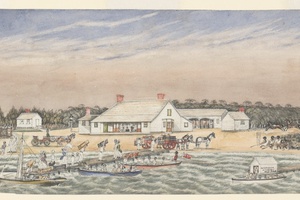
Although not the first hotel built in Port Melbourne (the Marine hotel on Beach Street was the first by a month), it is certainly one of the most important in terms of the history of the area’s pubs due to its owner, Wilbraham Frederick Evelyn Liardet. Liardet built his hotel in 1840 as the Brighton Pier Hotel providing accommodation and refreshment to Melbourne’s early colony - those who stepped off the ships docked in the bay arriving from far away lands, just as he did, to begin a new life. Despite his standing as a leader in the community, Liardet was not exempt from the grave economic depression that hit Melbourne in 1841. Liardet and his sons, Frank and Hector, battled dwindling resources, nearing bankruptcy, to keep their hotel afloat. Once the threat of closure was avoided, Liardet left the Pier Hotel to his sons and pursued his love of art, evidence of which we can see in his sketches of the hotel and beach.
pastportproject
-
The Local
Carl Frederick Julius Seismann, German immigrant, prominent businessman and licensee of the Royal Mail Hotel (now called The Local) led an anti-temperance group made up of local publicans. The Royal Mail Hotel, established by Seismann in 1872, was one of the places that held the group’s meetings. The group strategised on ways to fight the imposing threat of hotel closures and the restrictions placed on drinking during the 1880s by temperance advocates. This didn’t stop the Royal Mail being slated as one of 23 Port Melbourne hotels named for closure in 1888. The decision was overturned two years later and has been successfully operating as a pub ever since.
pastportproject
-
The Exchange Hotel
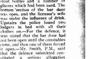
‘The six o’clock swill’ was a phrase used to describe the frenetic ‘swilling’ of beer before the hotel’s restricted 6pm closing time. For some of the publicans in Bay Street, including the Exchange’s Norman Morris Dalwood, the 6pm regulation established during the First World War, didn’t mean very much. Dalwood would continually flout the regulation. On one evening in 1923, police raided his establishment to find open beer bottles, used wine glasses and people lying fully clothed in their beds upstairs ‘asleep’. Charged for still serving after the legal closing time, he argued that his bar door had not been open until the police had forced it open; he had therefore committed no crime. Dalwood said it was a police conspiracy! Unfortunately, the judge found his story nonsense and fined him £7.
pastportproject
-
The Rex
'Tragic Endings'. So reads the suicide notice of the Victoria Hotel’s licensee, John Doherty, who killed himself upon hearing news of his family members’ passing in his homeland of Ireland. He was 27 years old. It was a tragic end for the publican of the Victoria Hotel, now called The Rex, whose reputation as a champion boxer made him well liked amongst the Sandridge community. In Doherty’s days the hotel also had small buildings attached behind, one in particular where he hosted amateur boxing championships.
pastportproject
-
The Rose
Billy ‘The Texan’ Longley was a member of the Federated Painters and Dockers Union and a leading underworld gang figure in the waterfront area during the 1960s and 1970s. Although his more infamous crime, the murder of union secretary Pat Shannon in 1973 occurred in a South Melbourne hotel and resulted in his incarceration two years later, his previous criminal activities have been documented as including the killing of three dockworkers at the Rose and Crown Hotel (now known simply as The Rose) in the mid-60s.
pastportproject
-
Bay and Bridge Hotel
One family that lived in and ran the Chequers Inn, now known as the Bay and Bridge Hotel, were the Robinsons. In 1928, Alfred, Stella and Clarence Robinson were implicated in a large-scale police raid that made newspapers across the country. Police found goods with an estimated worth of £3000 that included twill fabric, cutlery, glassware and sporting guns amongst numerous other things. The family was charged with the possession of stolen goods, some of which were taken all the way from Ballarat, and to which they plead not guilty. The father Alfred claimed that two other men who were responsible and that he had only “pinched” a suit from a bundle that was there. Unfortunately, the judge was unconvinced, letting Stella and Clarence go but sentencing Alfred to 3 years hard labour. The hotel’s criminal associations continued in more recent years with a shooting in 2003 before closing down and reopening as the Bay and Bridge Hotel in 2011.
pastportproject
-
Prince Alfred Hotel
The Prince Alfred Hotel was born with a royal connection. It opened the year Queen Victoria’s son, Alfred, visited Sandridge and passed the hotel’s site, subsequently providing it a name. The hotel become the last places local worker Minnie Hicks was seen alive – July 5, 1894. Minnie was said to have spent her last night on a hotel crawl with friend Rose, moving from The Rose and Crown down Bay Street. Jordan reported the murder to the police, but it was soon discovered that it was Jordan who had killed her. Evidence of Minnie’s gold brooch and some of her hair were found in his possession sealing his fate. Jordan was found guilty and hanged in August 1894, after what was noted to be an incredibly quick trial.
pastportproject
-
Mardo's
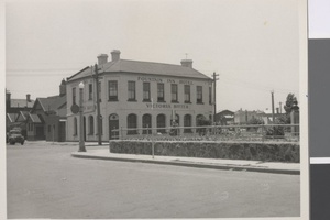
At the north end of Bay Street, the current Mardo’s has had many names, the first being the Fountain Inn. It is here we have an unsolved mystery – the safe heist of 1939. Licensee Roy Ballhausen and his family were away from the inn attending a picnic when thieves broke in. As there was no sign of forced entry through any of the doors or windows, it was assumed they used a skeleton key. Described in a local newspaper as ‘a most audacious theft’, the thieves blew up the inn’s safe, using a mattress to muffle the noise and stole its contents consisting of money and gold watches totalling £140. The thieves’ identities have never been discovered.
pastportproject
-
Twin Beacons
The Port Melbourne Leading Lights are twin beacons, built in 1924 to mark the centre of the Port Melbourne Channel from Port Phillip Bay. The beacons were visible for 14 nautical miles to guide maritime vessels through the piers until being replaced by modern navigational technologies.
pastportproject
-
The Front Tower
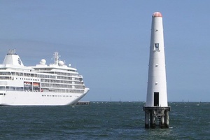
The sea based front tower is a 16-metre tall, timber framed lighthouse tower constructed on wooden piles. Positioned just offshore between Princes and Station Piers, the tower was originally linked to the shore via a wooden footbridge no longer extant. Elevated at a height of 14 metres above sea level, the fixed light that was projected from the tower to mark the centre of the Port Melbourne Channel is no longer functional.
pastportproject
-
The Rear Tower
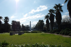
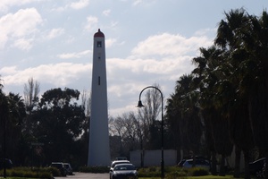
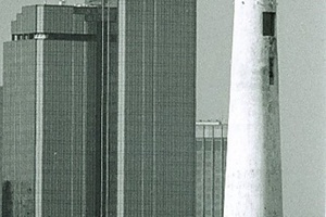
Set 500 metres north of the front tower on land, the rear tower is a 26-metre tall white concrete lighthouse tower with bright red dome. It featured an occulting light elevated at 24 metres above sea level, above a tri-coloured directional light indicating the centre of the channel in a narrow arc. Today only the directional beam remains operational.
pastportproject
-
Silent Sentinels
The front tower is located just offshore between Princes Pier and Station Pier, and was historically linked with a footbridge that is no longer extant. While no longer operational, it remains a visible and significant reminder of the Port’s history. Within a direct line of sight to the front tower, the concrete rear tower is located half a kilometre north within the Beacon Cove residential development. The directional beam is still operational, and with listings on the National Trust and Victorian heritage registers, remain a historically and socially significant presence within the community.
pastportproject
-
Leading Lights
Leading lights or beacons (also known as range lights in the United States) are used to assist maritime vessels in navigating narrow and dangerous channels. They operate in a pair, with the rear light positioned at a higher elevation behind the front light. Of particular use for navigating at night, the lights only become aligned with each other when a vessel is on the appropriate bearing, therefore indicating the correct course for navigating a narrow or shallow channel. For more information on these beacons follow this link to the Port Melbourne Historical and Preservation Society website: http://www.pmhps.org.au/2015/07/the-leading-lights
pastportproject
-
Guiding Ships
The Port Melbourne Leading Lights were built in 1924, and guided maritime vessels by marking the centre of the Port Melbourne Channel from Port Phillip Bay. They replaced the first markers to define the route into Port Melbourne Channel, which were replaced with boards erected on the beach in 1849. In 1866 these were changed to a green flashing light on the end of Railway Pier and a beacon on the beach. The lighthouses that stand today were built following the dredging of the channel.
pastportproject
-
Heritage Listing
As an iconic bayside landmark, the Leading Lights are a significant part of the Port Melbourne landscape, and have been listed on the Victorian and National Trust heritage registers, as they are an architecturally and historically significant pair. In conjunction, the connecting easement is an important feature marking the line of sight between the two lights and through the channel. The lights have a historic and social significance as part of the complete navigation system for Port Philip Bay and the Port of Melbourne. As an important visual link between the Princes and Station Piers, they also reflect the functional link between these places in the pattern of shipping during the 1920s and 1930s.
pastportproject
-
Beacon Cove placement
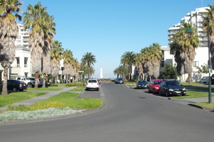
As part of the redevelopment of the industrial port area around the Station and Princes Piers during the 1990s, the leading lights were incorporated into the new residential streetscape of Beacon Cove.
pastportproject
-
Princes Pier, Fond Farewells
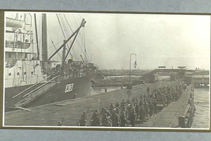
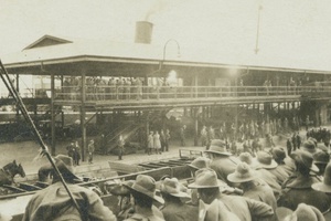
When thinking about the effects of World War One on Port Melbourne and its people, Port’s piers are a clear starting point. After more than 50 years as the ‘gateway’ to Australia, the outbreak of war saw Railway Pier served as a place of departure. The first convoy in October 1914 saw sixteen transport ships depart for the front, and over the course of the war thousands more departed via Town Pier, Railway Pier and Princes Pier. Early embarkations were initially to be kept secret, in response to the German presence in the Pacific. However images of embarkations dating from later in the war reveal this initial secrecy gave way to large public affairs, the piers crowded with family, and the ships festooned with streamers.
pastportproject
-
Princes Pier, Home Front
Over the course of the war, 1,500 ‘Port boys’ departed for the front. In addition to this depletion of the population, the war had numerous effects on domestic life in Port Melbourne. Port’s hotels were mandated to be closed for the duration of troop embarkations and disembarkations, leading to protests by its hotel-keepers. At the piers, the same patriotism which led to the charitable works of the Busy Bees and the WWC also manifested as strong anti-German sentiment. Naturalized German and Austrian stevedores clashed with their Australian counterparts, and tension peaked when a German stevedore threatened to trample the British flag, eventually culminating in fights and riots.
pastportproject
-
Station Pier, Aussie Again
Troop ships returning wounded soldiers began arriving in Port Melbourne in July 1915. The first of these, the Kyarra, arrived in sombre circumstances. Accounts of the arrivals at Port Melbourne reveal a mixture of emotions: one soldier’s relief at being “Aussie again” contrasts with the sombreness of an arrival in 1917, where the ship was greeted by “a quiet clump of relatives [waiting] in silence.” Port Melbourne’s Women’s Welcoming Committee formed in response to these sombre arrivals. As well as gifts of cigarettes and chocolate, the committee erected arches inscribed with the motto “Australia is proud of you: welcome home to our Brave Heroes.”
pastportproject
-
Port Melbourne Town Hall, Womens Welcoming Committee
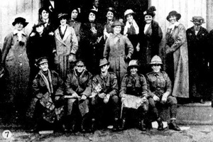
In 1914 as Australia entered the war, a group of local Port Melbourne Women realised that no regard was being paid to the returning sick and wounded at the Piers. Many of these women were already serving on the Red Cross committee or AWA and the forming of their new group ‘The Women’s Welcoming Committee’ was not initially met with admiration. Realising that this was a cause too important to let politics get in the way, the women powered on welcoming over 100,000 servicemen over the course of their work.
pastportproject
-
Port Melbourne Town Hall, Donations
Donations for the returning soldiers included goods such as fruit, cakes and flowers, mostly gum leaves and wattle. Cigarettes and other useful items were collated in the town hall. The Victorian railways agreed to carry free of charge to Port Melbourne station, parcels addressed to ‘the returning wounded soldiers’. An excerpt from the Argus newspaper in September of 1919 reads: Since July 1915, this committee has tendered welcomes to over 100,000 returning soldiers and sailors with “smokes” and refreshments. The amount expended in doing so totals over 3000 pound. Excepting occasional donations that amount had almost entirely been collected in pennies.
pastportproject
-
Port Melbourne Town Hall, Fundraising Efforts
The Women’s Welcoming Committee was pro-active in their pursuit of donations for their cause. Members were stationed at the two city railway stations during peak times to receive donations on days prior to the arrival of troops. They held several major events such as the Carnivals of 1916 and 1917 that were held at the Port Melbourne Cricket ground. There were military displays, novelty competitions and the Port Melbourne cup for draught horses. The Argus and the Standard newspapers were supportive of the Committee and enabled them to reach out to the general public for donations.
pastportproject
-
1855 Map
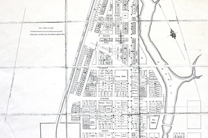
This is an 1855 map of Sandridge. If you look at the map, on this corner there used to be a large fish market, now replaced by a large apartment complex.
pastportproject
-
1895 Port Melbourne Map
In this map of Port Melbourne from 1895 you can see early businesses on Bay Street and the surrounds. At the bottom centre of the map you can see the old Pier, now replaced by the Yacht Club.
pastportproject
-
Fountain Inn
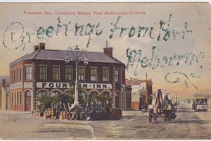
This is a postcard from 1892 showing the old Fountain Inn on Crockford Street. Notice the cable car and horse cart in the photo.
pastportproject
-
Railway Pier Postcard
This hand-tinted postcard shows Railway Pier, now called Station Pier, in 1914.This hand-tinted postcard shows Railway Pier, now called Station Pier, in 1914.
pastportproject
-
Nott Street Primary School
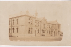
This postcard shows the old Nott Street Primary school and dates from 1910-18. Also known as State School 1472, the school was opened in 1874. As Margaret and Graham Bride point out in The Borough and its People, by 1880 the school fell into disrepair. ‘The school grounds remained poorly drained and the toilets inadequate. Twice in its early years, the school was closed: once in 1891 when the caretaker had typhoid and in 1912, during a diphtheria epidemic.’
pastportproject
-
Centenary Bridge Panorama
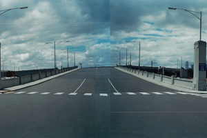
Taken just prior to the Bridges demolition in 1991, this photo is taken from the Pier looking back towards the city. To the right of the photo you can just make out the Swallow and Ariell Biscuit factory in Princes Street.
pastportproject
-
Lolly Labels
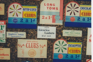
Series of labels from the Lagoon Confectionary company. Lagoon Confectionary began operations in 1929 in Williamstown, before moving to Port Melbourne in 1970. They are best known for inventing the Sherbet Bomb, but does anyone remember these other confections?Series of labels from the Lagoon Confectionary Company. Lagoon Confectionary began operations in 1929 in Williamstown, before moving to Port Melbourne in 1970. They are best known for inventing the Sherbet Bomb, but does anyone remember their other confections?
pastportproject
-
Murdoch's Shop
This is an image of Murdoch’s Shop, taken c1880. Does anyone know where this was?
pastportproject
-
McLean General Merchant
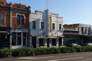
This image was taken around 1910, and shows the McLean General Merchant, originally built in 1859 by A.G Warren as a shop and dwelling. Margaret McLean purchased the shop in 1907, adding a new shopfront and recessed doorway which you can see here. The building was eventually bought in 1919 by the Faram Brothers, gradually evolving into their family hardware store which operated for over 87 years. The decorative iron lacework remains, complete with the Port Melbourne coat of arms set into the verandah frieze.
pastportproject
-
1945 Aerial Photo
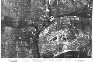
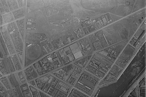
This is a 1945 aerial photo of Fishermans Bend, taken by the Department of Crown Lands and Survey. You can see in the centre of the image the old Fishermans Bend aerodrome, which closed down in 1957.
pastportproject
-
Map of the City of Port Melbourne
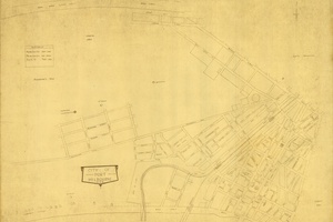
This is a 1931 map of Port Melbourne. You can see difference in the early layout of the suburb at this time, particularly to the South of Graham Street, and the beginnings of the Garden City development.
pastportproject
-
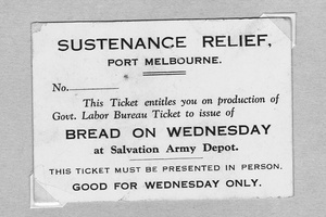
Sustenance Relief Card
This is an example of a Sustenance Relief Card, dating from the early 1930s, following the Great Depression. These cards were used as vouchers to redeem provisions, in this case a loaf of bread.
pastportproject
-
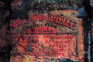
Swallow and Ariell Biscuit Poster
This shows an old Swallow and Ariell poster advertising their biscuit range. Does anybody remember these types?
pastportproject
-
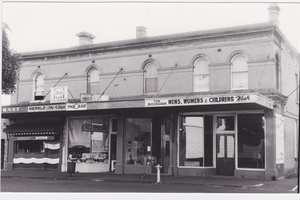
Tom Buckingham Clothes Shop
This is shows the old Tom Buckingham Clothes shop, taken in the 1970s. Does anybody remember shopping here, and where it is?
pastportproject
-
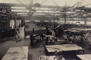
General Motors Holden Factory
This is a photo from 1941 showing the General Motors Holden Factory when it was being used to construct Beaufort Bombers during the war. The Beaufort Bomber was a twin-engine torpedo plane designed in the United Kingdom. The photos were taken by EJL Gibson, the consulting engineer to GMH at the time.
pastportproject
-
General Motors Holden Engineering workshop
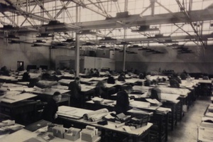
This photo shows the engineering workshop at the General Motors Holden Factory. This was part of the assembly workshops at the factory provided to construct the Beaufort Bomber planes during the war. It was taken in 1941, by EJL Gibson, the consulting engineer to GMH at the time.
pastportproject
-
Players and Spectators in Fight
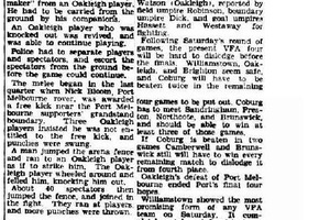
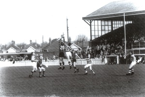
As this article from The Argus in 1949 shows, games at the Port Melbourne oval were often rough affairs, with frequent fights and brawls.
pastportproject
-
North Port Oval
This aerial photo, taken in 1948, shows the home ground of the Borough Port Melbourne Football Club, North Port Oval. The oval hosts the team’s home game matches as well as semi-finals, preliminary finals and finals in the Victorian Football League (previously the Victorian Football Association). With a grass surface 150 metres by 125 metres, the venue’s capacity is 12 000. A popular venue throughout its history, the Victorian Football Association Division 1 Grand Final between Port Melbourne and Williamstown attracted the oval’s all time record crowd of 26 000 in September 1964.
pastportproject
-
Former Murray's Grocery Store
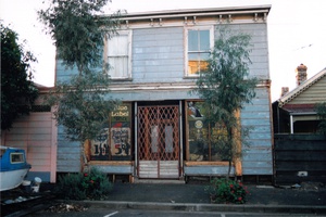
Built in 1863-4, this former grocery was built by Margaret Murray, and is one of a few surviving timber framed combined shop/residences of the period. This photo was taken by PMHPS member Ron Laing in the early 1990s, and shows the old shop signage, before it was recently renovated and removed.
pastportproject
-
McLennan's Grocery Shop
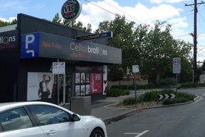
This image shows the old McLennan’s grocery shop in the 1960s, now a Cellarbrations liquor store.
pastportproject
-
Garden City Fence
Conservation Architect Fraser Brown discusses the original fencing of the Garden City development, and the one remaining gate left in a surprising location.
pastportproject
-
Champion Goalkickers of Port
In 2014, Port Melbourne Football Club named the ends of North Port Oval after two of the Borough’s champion goalkickers. Bob Bonnett’s career from 1952-1963 included 933 goals across227 games, and he led Port’s goalkicking in each season, including a century in 1961. The other end of the ground was named after Fred Cook, who was coached by Bonnett during his 258 game career between 1971 and 1984. Cook kicked 1238 goals in his time at the Borough, holding the records for most games and most goals with the club.
pastportproject
-
Street Photo
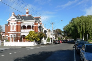
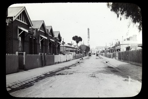
This photo was taken by Frank Norman Heath, a notable Australian planner, best known for his significant involvement with the Housing Commission of Victoria. This photo shows a street in Port Melbourne, terminated by a chimney, but can anyone identify the street?
pastportproject
-
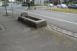
Street Furniture
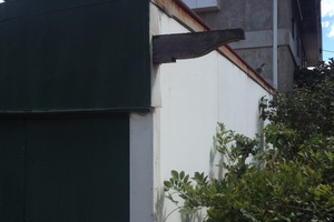
Does anyone know what this piece of street furniture was used for? Do you know of any other similar examples in Port Melbourne?
pastportproject
-
Malcolm Moore Industries
Did anyone work at the Malcolm Moore Industries factory, or know someone that did? What memories do you have of the place?
pastportproject
-
Rootes Factory
This is the former Rootes Factory built in 1941, which was later used to build Chrysler cars. Did anyone have family members that used to work here, know anything of its wartime history?
pastportproject
-
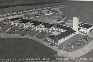
Fishermen's Bend Community Centre
This drawing shows a proposal for the Fishermen’s Bend Community Centre which was to be built near the existing shops. It was drawn by Ernest Fooks, a significant émigré architect that arrived in Australia from Vienna in 1939. As the City of Port Phillip Heritage review notes: “The original masterplan also proposed a range of community facilities, the inclusion of which had been strongly urged by the Housing Commission of Victoria’s social reformer members. The central avenue was to have two blocks of shops flanking its northern end (The estate’s main entrance off Williamstown Road) with a community centre forming a focal point in a large park at the southern end. The provision of shops became the first priority, as it was recorded in the annual report that the nearest existing shops were a mile away and there was still no regular transport at that time.”
pastportproject
-
Nerre Nerre Minnim
Dean Stewart, Wemba-Wergaia man of Victoria, outlines the natural and aboriginal history of the Port Melbourne area, known by the Boonwurrung as Nerre Nerre Minnim.
pastportproject
